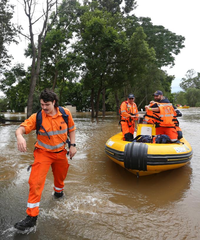
NSW is facing danger on multiple fronts with rain set to worsen, threatening floods and erosion as conditions deteriorate earlier than expected.
Areas stretching from Newcastle to the South Coast and as far inland as Oberon are in the danger zone, including western Sydney’s flood-prone Hawkesbury-Nepean area.
Warragamba Dam in Sydney’s west began overflowing at 2am, which was “well ahead of predictions,” Emergency Services Minister Steph Cooke said on Sunday.
The Hawkesbury-Nepean Rivers also exceeded major flood levels on Saturday night.
A developing east coast low pressure system will drive even further rain in the coming days.
Residents in a number of areas have been warned or ordered to evacuate, but Ms Cooke said people don’t need to wait to be told to leave.
“If you are feeling uncomfortable or unsure about your circumstances, and there is an opportunity for you to leave earlier, don’t necessarily wait for an evacuation order to be issued to your area,” Ms Cooke said.
“Take the opportunity if you can to leave early if you are worried about your personal circumstances,” she said.
SES Commissioner Carlene York said the agency conducted 29 flood rescues in the past 24 hours.
Plans are also underway to evacuate youths isolated at a recreation camp near Bago, west of Port Macquarie, Ms York said.
While the SES endeavours to issue evacuation warnings before orders, the speed the situation unfolded overnight meant several areas were ordered to evacuate with no warning.
Ms York said locals should monitor the situation on the ground along with checking for SES warnings.
“Be prepared and be aware of your surroundings so that you can make a sensible and safe decision to get to a location of safety,” she said.
The SES will be joined by other agencies, including about 100 Australian Defence Force members on Sunday, assisting with sandbagging and other preparedness measures like doorknocking communities to warn of the flood threat.
“At this stage, we’ve asked them to really concentrate on the Hawkesbury-Nepean Valley area which seems to be the big risk,” Ms York said.
Floods are nothing new for the catchment’s residents, who have faced severe flooding several times over the past few years, including in March and April.
“They are quite accustomed in a way in terms of what to expect, but we also know that every flood is that little bit different and it’s important that we don’t become complacent,” Ms Cooke said.
The weather-front battering the state’s east coast is forecast to get worse before it gets better, with wild winds, rough seas and heavy rain expected to last until Tuesday.
Bureau of Meteorology hazards preparation and response manager Jane Golding said a coastal trough lingering since Friday has deepened further and an east coast low pressure system has formed off the Mid North Coast.
“That’s produced some extraordinary rainfall rates over the last 24 hours … many locations have seen up to 200mm and some close to 300mm,” Ms Golding said.
It’s expected to move south along the Hunter and Central Coast before hitting Sydney in the next 24 hours, before shifting offshore.
Thunderstorms are also expected, potentially delivering even more rain that could trigger flash floods, Ms Golding warned.
EVACUATION ORDERS IN PLACE IN PARTS OF:
* Pleasure Point, Bents Basin, Wallacia, Camden, Woronora, Chipping Norton, Georges Hall, Lansvale, Moorebank, Warwick Farm
EVACUATION WARNINGS IN PLACE IN PARTS OF:
* East Hills, Picnic Point
MAJOR FLOODING POSSIBLE ALONG:
* Hawkesbury and Nepean Rivers, Colo River


